Search

Meerkat Travel Gang

Come on in, the water's fine

Month

April 2014

Arches National Park, from Moab Utah

As is our habit we left the campground a bit late in the day (noon is our average) and if we had followed the advice of the former tour guide, we would have spent the whole day at Island in the Sky and it is clear we could easily have done that… it’s gorgeous, with lots of hiking trails and overlooks. However, we couldn’t go to Moab and not see the iconic Arches 🙂 so we covered ourselves in sunscreen, paid our $5 entrance and beelined for the Double Arches after a bunch of switchbacks and a couple scenic veiws.

We are on the walking trail, heading to Double Arch

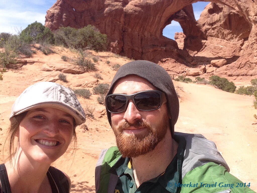
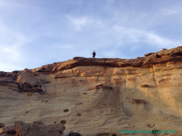
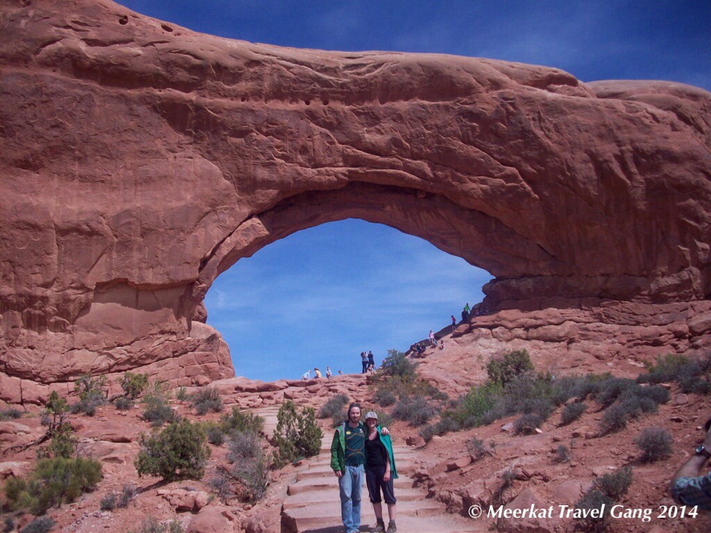
The Double Arch trailhead in the Windows Section of the park, in a loop with 2 parking lots and a bunch of trails all of which are really short and level (just hot… so take enough water). A couple of minutes after parking the motorcycle we’re already in sight of the arches and realizing how incredibly high they are off the ground. I tried to take a picture showing people sitting in the arch just to get an idea of scale, but that doesn’t even do it justice. Unlike other attractions though, here you can literally climb up into the arch – pleasantly cool in the shade. However it seems like it is usually quite busy. The shorter the hike the more kids there will be we’re slowly learning.

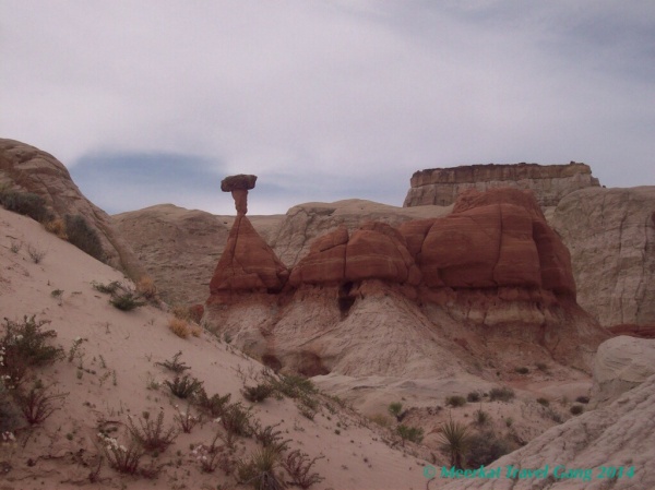
Despite the scale, the vividness of the sandstone, and the alien landscape. The most interesting charasteristic of the park is its channels of rock jutting out of the ground. Seemingly common at first, i then read a diagram describing the alternating geological age of the different layers of stone and how they’re affected by weathering. Because over millions of years, the more brittle stone under the older stone slowly gives away, creating holes, then the iconic arches if the weight holds i suppose. Not mind blowing i know but still interesting to see how they came to be, and others in the process of becoming that will finally arch long after were gone. In a way it felt like i was viewing beings whose lifetimes were millions of years long, immortal sandstone giants.

The arches look big... but when you see it and stand under the arch, it's impossibly huge! Showing the size of the people hanging out hopefully illustrates it a little.
The arches look big… but when you see it and stand under the arch, it’s impossibly huge! Showing the size of the people hanging out hopefully illustrates it a little.

We did a quick walk through the north window for a couple of photos and before leaving the loop we had a look at a random overlook of a flat valley; at first it looks like nothing, then you read the sign and it explains how the collapsed salt valleys are formed. Looking at an aerial picture of the valley it would look like lots of deep gauges in the rock, all criss-crossing in the same general direction. 🙂

In Arches Nat'l Park
In Arches Nat’l Park

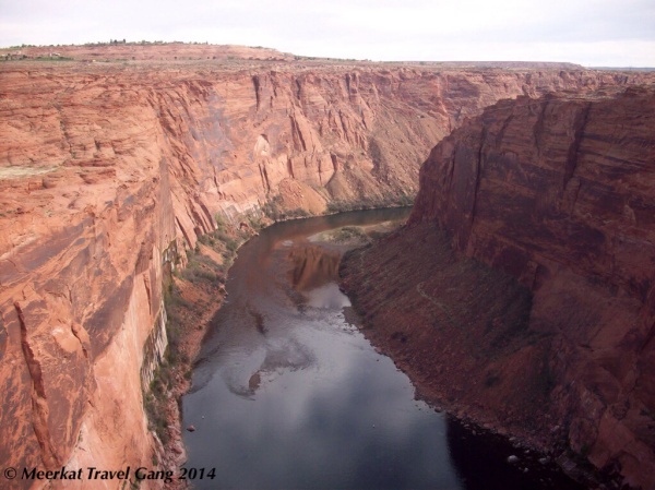
The road into the national park is really scenic – switchbacks steeply up red, rocky hills. The snowy La Sal mountains are visible all around the park too, which makes for a confusing view – desert, rock and sand in the foreground, then green mountains and white peaks in the distance. On the way out (and down) we had a gorgeous view of the valley… and on to Canyonlands 🙂

Cruising the road to Moab, Utah

A lot of what we saw in Utah...
A lot of what we saw in Utah…

Finally we are getting to the parts of our trip where we are going to the ultra-awesome National Parks, hikes and drives that we have been seeing on pictures and postcards (or national geographic as a kid)! The first major park was Grand Canyon, and they are getting more frequent and mind-blowing as we slowly crawl west. Leaving Big Water and Page, we went around the southeast of Utah on the AZ-98 and US-160 to make a big, slow upward curve to Moab on the US-191, so we passed Monument Valley and saw it in the distance, and some resembling formations near the road … but with rearranged plans from New Mexico and Colorado, we kept on going to Moab without a Monument Valley stop. Oh well, we still have a bunch of sights that are staying on our to-see list.

The picture says it all

Moab, UT was quite a surprise! Well, before that we got into Page expecting a bustling city and it was dry, dusty and seemed very low-key and unassuming. So we adjusted our expectations and kind of thought Moab would be similar; apart from similarities in weather and landscape, Moab is completely different! It looked and felt like a holiday-goers town; ATVs everywhere, cyclists, other motorcyclists and lots of campers/RVers… and many many little cozy coffee shops, bistros and adventure sports shops. An outdoors heaven! Skydiving, canyoneering, climbing, hiking, kayaking, 4-wheelers. Oh my gosh! Driving out of Moab they have a sign saying “Moab, keep exploring”. You know if they have multiple consignment shops for outdoors gear and clothing that it’s an active town 🙂

Well, that's what it looks like when you see the rod winding out in front of you like this
Well, that’s what it looks like when you see the rod winding out in front of you like this

Rolling into Moab right before sunset we had hoped to couchsurf, but not having a response or acceptance we started looking around for camping spots… and there are lots. We settled on one that is suitably cheap and actually had spots for tents rather than RV sites with no hook-ups :)plus  with all the amenities we were sorely missing after camping for a couple of days already – laundry & shower! Pack Creek Campground is a super friendly, convenient campground and RV park, not on the main street (so it’s got less traffic noise and blown-up dust). If interested, with tax it came to about $19 a night.  Free potable water, sinks, hot showers, clear bathrooms, and a 6 machine coin laundry and they sell detergent/other washing supplies in the laundry room which is behind the bathrooms. We even met a guy who used to be a tour guide in this area and he gave us really awesome advice for things to see and places to go – thanks dude! 🙂 He impressed on us the necessity to spend more time at Canyonlands, and not necessarily Arches; he actually said that with a choice between the two, we could just spend the whole day at Island in the Sky in Canyonlands National Park, but we managed to see both that and Arches National Park (enormously happy!) And after hearing from other people that also visited Canyonlands, with limited time Island in the Sky is the best area to check out.

Our cozy campsite at Pack Creek in Moab, with the luxuries of a picnic table, a fire ring and shared showers... After 2 days of carrying all our own water, this was really comfortable.
Our cozy campsite at Pack Creek in Moab, with the luxuries of a picnic table, a fire ring and shared showers… After 2 days of carrying all our own water, this was really comfortable.

The last of the two nights we spent there (after a quick, brothy camp stove dinner) we had to do laundry since all our clothes were dusty and sweaty, and we must have looked pretty funny sitting in the laundry room, with our electronics around us either charging or writing some posts… And yes, Page and Moab were incredibly hot!  But it was a cool campground, maybe 1/5th tents but many RV’s, and we really wish we could have rented bikes and cruised around Moab for a few days, done some trails, and gone out downtown.

Page Arizona part 2 – Antelope Canyon

This guy, Leonard Nez, is a Navajo tour guide; not only does he know all the rock formations, he is absolutely expert with cameras in the canyon! A lot of people's cameras were taking super dark, blurry photos - you just give him your camera, he makes a couple of adjustments, and takes a pic... and it's perfect. Perfect angle, color, not blurry at all! Bloody amazing
This guy, Leonard Nez, is a Navajo tour guide; not only does he know all the rock formations, he is absolutely expert with cameras in the canyon! A lot of people’s cameras were taking super dark, blurry photos – you just give him your camera, he makes a couple of adjustments, and takes a pic… and it’s perfect. Perfect angle, color, not blurry at all! Bloody amazing

To finish off our Page trip, since we couldn’t do Vermillion Cliffs or Coyote Buttes, we decided we definitely had to see Upper Antelope Canyon. As I understand it you can not really visit without an Navajo guide/ a guided tour since the canyon is in a Navajo park. You can either drive to the park entrance and arrange to hire a guide, or you can book through a company in town. I say ‘really’ since there is a possibility you can take a 2 day hike in from another entrance or something, but I’m not 100% (you still need a guide to enter the canyon).
Link to the tour company we went with. $35 a head, really great ride our and tour
If we could do it again, I’d say shell out a couple more bucks to go around mid day, that would be the best time because it got a little dark during our 5pm tour.

I can't remember the name of this formation, but it's all so pretty!
I can’t remember the name of this formation, but it’s all so pretty!

To start out, we show up at the tour shop in town and together with a group of 10 strangers load up into a kind of 4×4 safari truck to drive 10 minutes to the park entrance. From there it was another 10 minutes across a sandy riverbed to the canyon entrance, a really fun bouncy run; every now and again we were bouncing 2 feet up on the seats. But we got out, and as our guide explained a bit of history of the area and the canyon we began the tour. It’s narrow but maybe 60 feet tall, all shaped and carved really smooth by rivers/rains, a beautiful red, tan and khaki mix. The floor is a soft bed of sand and we walk through slowly taking pictures, gazing up, looking at gorgeous designs in the stones and natural sculptures in the canyon wall that the guide pointed out, some that looked like bears, eagles and so on.

Antelope Canyon is on the Navajo Reservation

It’s a 20 minute slow walk with a group as you gaze around, upwards, forward and back since the light affects the formations and sculptures differently from different angles.  Some quite plain, and some quite beautiful, complex, and unique sandstone designs.  It was also really helpful that our tour guide Leonard Nez knew all the best spots to take memorable photos, and allowed us breaks to snap some photos.  He also said he’d seen every kind of camera that’s come through there and helped everyone with camera settings as a bonus.  We got to the end of the canyon after a dozen stories and mini photo shoots and he stood there and told a short story about what antelope canyon meant to him and his people, and their philosophy with regards to living in the area and their relationship with the area which was quite interesting and hopefully sincere.  After that we walked back through the canyon to the 4×4 for a bumpy ride back to town while basking in the knowledge that we had just visited an amazing place.

Oh yeah it didn’t fit anywhere above but it’s called Antelope Canyon because they used to run through there and around the area when it was more of a grazing grounds.  Now with water and rains and vegetation shifting they don’t visit as often.

Our 2 nights of BLM camping :)

Page Arizona and Grand Staircase Escalante National Monument Camping

Leaving Flagstaff we took the 89 straight up to Page (with a detour to Wupatki on the way, which is in a different post and picture gallery). It was a gorgeous open ride and quite a sight passing the monument valley area on our left side. We got into town at 2ish and crossed the Colorado river on the 89 north into Utah and stopped at the Bureau of Land Management, the Big Water Station.

We stopped long enough to go out on the bridge walkway and take some pics.

They were super helpful and gave us great advice on what to see, where to camp and so on, I’ll embed their link below. BLM is a great national department + free camping and they promote the ‘leave no trace’ initiative. At most BLMs, like this one, you just register for a free camping permit; I guess they just want to know how many people are camping there at a time. Haha, when we filled out the form it had a space for an emergency contact and the guy said “Just keep in mind that the only time we use that emergency information is when we’re telling people to come claim the bodies… so choose someone who can handle it”. Ok…

They said we could hike anywhere we could physically get to... so we did.
They said we could hike anywhere we could physically get to… so we did.

Ours was a great little site off the beaten path, where we didn’t see anyone within miles for 2 days unless they were driving through the park. No wild animals that we saw unfortunately, but word of caution it is kind of dusty so prepare for small piles of dirt on your sleeping bag/in your tent when you wake up. Even after we rinsed out our mouths we were still crunching on some sand. Speaking of rinsing… any and all water you need, want or should have you have to bring with you from outside the BLM land. Visitor centres have spigots where you can get potable water for free, but they recommend 1 gallon per person, per day just for drinking water; double that for cooking water, washing dishes, brushing teeth etc. The last morning at GSENM we tried out our portable solar shower and it was awesoooome!

Link to Grand Staircase BLM site!

That's our own, uninterrupted mountain view; all natural, no buildings, traffic noise or alarm clocks :)
That’s our own, uninterrupted mountain view; all natural, no buildings, traffic noise or alarm clocks 🙂

We couldn’t drive too far up the path because although it was packed dirt, it was a little sandy for a touring motorcycle. So we set up camp, checked out the area, climbed the cliff nearby and read our books under the setting sky.

Each of us had our own reading spot as the sun went down

Honestly this area is awesome for 4×4 vehicles, with Bryce Canyon above you, Vermillion Cliffs below, even Zion to the west. It really sucked that on our bike we couldn’t make it to Vermillion, though you do need full-on 4wd there anyway. We looked for hikes nearby, and ended up doing Toadstools which was pretty cool – an easy, even hike and then you get to a small canyon and there are large, ancient stones balanced on little eroded spires. I’ll post the link to other hikes you can do in the area as well.

Viva la days day hikes! :)
Viva la days day hikes! 🙂

Link to Grand Staircase BLM hikes
Also part of the toadstools hike

After hanging out for a bit, we headed to town to join a tour through Antelope Canyon which we’ll post about in the second part.

Wupatki Nat Monument… ooohh

Wupatki National Monument

As I’m writing this post I can’t believe that it has been two weeks since we visited Flagstaff and Wupatki… (We really need to catch up!) Well, we didn’t have enough time in Flagstaff to squeeze in Wupatki National Monument between Grand Canyon and Sedona, however we were tipped off that Wupatki was a unique spot by our couchsurfing host, so on our drive to Page we swung through the north entrance for an hour detour and it was not only worth the detour, but I’m also glad we didn’t rush it by trying to run through it the previous day!

It is just over 40 miles to north north-east of Flagstaff on the US89 and since we got up and out earlier than usual, we could spend some time leisurely exploring some ruins and short trails. Wupatki Nat Monument preserves old homes & shelters (or the ruins of them) from people who lived in those valleys in the 1100’s or fled there after the eruption of Sunset Crater volcano. A surprising amount of the walls are still standing, and I’m not sure if they were rebuilt by people who settled there later possibly a different native american group. There are little housing compounds right near the northern entrance, but driving a couple more miles to the visitor center you can see a much larger set of buildings, which looks almost like a communal meeting place (or as I imagine it, where everyone would hang out together during the day, before going back to the more compact family hearths at night). There is even a big ball-sports arena 🙂

And if you go make sure you check out the cool natural blowhole near the ball pit. From cooling temperatures the pit underground naturally breathes in and out it pretty awesome.

The entryways and little window holes are still intact in some of these ruins, and were all so low that we had to double over to pass through – there’s one trail that allows you to walk through the ruins; Box Canyon ruins, if I remember correctly. We were told that these ruins and old houses – as living areas of those who’ve gone before – as sacred to native American tribes and that they believe the spirit of those ancestors still inhabit their old homes. That puts a different spin on looking at something that might otherwise just seem like crumbling rock, but more than that it made me imagine people moving about, doing household things in these domestic areas that they built and erected with their bare hands… I am super pleased that we could spend an hour or two strolling through!

Resources 🙂

Wupatki National Monumnet by NPS.

Grand Canyon & Sedona photos

The Grand Canyon from Flagstaff, Arizona

We rolled into Flagstaff after a long day of driving, and took half an hour or so to get our minds off the road once we were at our couch host’s place. We stayed with a North Arizona University student & his roommate, both of whom are doing Physical Therapy – Philipp and Travis. They are absolutely super hosts, and even though they were extremely busy with classes and studying for tests, they still hung out with us a bit.

From the left, me, Travis (roommate) and Philipp (host) & Kiernan

I felt like Flagstaff has two distinct but overlapping atmospheres – it’s definitely a student town, and also a quaint little town-in-the-mountains. I say little because the main downtown area is literally walkable from top to bottom; we spent some time at a wine bar (Vino Loco) with delicious wine and mouthwatering cheese (even a South African Havarti & peppadew!). There was an old fashioned 2 story balconied hotel where people were playing Irish music, we saw a speak easy, and a candy shop that would make you cry tears of sugar to try everything and being in the mountains, there were an inordinate amount of outdoors gear shops. Althoug it was a sunday night there were numerous shops with private events going on, and we could picture how enjoyable it would be to be back around their city plaza on a summer day or during their monthly art walk that Philipp mentioned. From pretty much anywhere in Flagstaff you can see Mt Humphries, wth white, snowy peaks, which opens as a ski destination every winter.

The next morning we were out the door by 8am and on our way to the Grand Canyon’s South Rim… While the South Rim is open both year round and 24hours a day, the North Rim gets too snowy/icy, so it closes for the winter until mid-May. Meh. I don’t think we would have been able to see both, anyway. Before you actually get to the Grand Canyon entrance you drive through the Kaibab National Forest for miles – that drive to the fee gate was much longer than I expected… but perhaps it felt so long because I was so excited to get to the actual canyon! 🙂

Grand Canyon!

It’s one of the more expensive parks i.t.o. admission fee (2 people on a motorcycle, we paid $25, instead of $5 or $10 like most other places), but it was well worth it! Our first look over the rim of the canyon was stupefying! The epic size and monstrous dimensions of the canyon made both our jaws drop; we just stood there for a while feeling hopelessly insignificant in the face of the sheer depth and width of this ‘cut in the ground’. The information tape on the shuttle bus said the average width of the canyon is 10 miles (16km), but its widest point is 18miles (28,9km). In its length, it’s 227miles (446km). Stupefying.

They have a really convenient shuttle bus that takes you around to all the scenic overlooks on the south rim, as well as to all of the trailheads. We just did an easy walk along the rim, along with going to a couple of the overlooks. You can hike all the way from the rim to the Colorado River way at the bottom, but it’s a multi-day hike. They also have several different colored bus lines that run along the rim, we started on the yellow, then rode the red line out to mojave point which is a fantastic overlook.

– M&K

Create a free website or blog at WordPress.com.

Up ↑